Showing posts with label charles river. Show all posts

Thursday, July 29, 2021

Town of Franklin, MA: Charles River Flood Model released

The Town of Franklin, in partnership with the Charles River Watershed Association (CRWA) and 14 other communities in the upper and middle Charles River watershed, is excited to announce the release of the Charles River Flood Model (CRFM). https://t.co/kv0FnrCMZu
Shared from Twitter:
https://twitter.com/TOFranklinMA/status/1420403438169513987

Press release document

The Town of Franklin, in partnership with the Charles River Watershed Association (CRWA) and 14 other communities in the upper and middle Charles River watershed, is excited to announce the release of the Charles River Flood Model (CRFM). Funded by the MA Executive Office of Energy and Environmental Affairs FY21 MVP Action Grant Program, and developed by Weston & Sampson, this flood model can help communities protect vulnerable populations and property from flooding.

The Charles River Flood Model visualizes the impacts of increasingly severe storm events that will become more common with climate change, then shows what happens if we invest in nature-based solutions such as land conservation, green stormwater infrastructure, and/or reducing impervious surfaces.

This model comes at an important time. Our region has seen approximately 9.5” of rain so far this month, an astounding 9” more than average for early July. Following Tropical Storm Elsa and subsequent rains; the Charles River remained above flood stage in Dover from July 12th to 17th according to the U.S. Geological Survey.

The Charles River Flood Model found that without intervention, a projected 2070 100-year storm will impact more than 50 critical facilities and flood up to 12,500 acres of land within the watershed. This exceeds the estimated 10,400 acres of flooding during the severe rains of March 2010, which is the most recent significant flooding event caused by rainfall to affect the region. These intense rain events will put many residents at risk, especially vulnerable populations such as low-income residents, the elderly, and those who suffer from physical or mental illness.
 
The model was also used to test the impact of developing land that is currently undeveloped but vulnerable to future development. Developing half of the watershed’s remaining undeveloped and unprotected land without flood control measures would result in a 33% increase in flooded area in the present day 10-yr storm, and a 20% increase in flooded area in the 2070 10-yr storm. Allowing undeveloped land to be developed without considerable flood protection will cause downstream flooding and directly impact vulnerable residents.

“CRWA is excited to have led this regional effort,” said Julie Wood, deputy director with the Charles River Watershed Association. “This is a critical step to taking action as a region to effectively mitigate the expected flooding impacts of climate change. The model provides valuable information that will allow communities to make informed decisions about policy changes and on the ground interventions”.

Investing in nature-based solutions brings other important co-benefits as well, including improvements in water quality in the Charles River, reduced heat island effect, cleaner air, increased biodiversity, and more.

Flooding does not follow political boundaries, and this tool will help create stronger regional collaboration between communities in the watershed to better understand and address flooding due to climate change. Participating communities include Arlington, Dedham, Franklin, Holliston, Medway, Millis, Natick, Needham, Newton, Norfolk, Sherborn, Watertown, Wellesley, Weston, and Wrentham.

Charles River Watershed Association uses science, advocacy, and law to promote resilient communities and a healthy river ecosystem. CRWA was formed in 1965 in response to public concern about the declining condition of the Charles River. Since its earliest days of advocacy, CRWA has figured prominently in major clean-up and watershed protection efforts that have dramatically improved the health of the Charles.

Contacts:
Julie Wood Deputy Director
Charles River Watershed Association 617-356-5060
jwood@crwa.org

Julia Hopkins
Communications and Outreach Manager Charles River Watershed Association 781-788-0007
jhopkins@crwa.org


Tuesday, July 6, 2021

Franklin Annual Report - 2020: Charles River Pollution Control District

ANNUAL REPORT OF THE CHARLES RIVER POLLUTION CONTROL DISTRICT

During Fiscal Year 2020, the Charles River Pollution Control District’s (District) regional advanced wastewater treatment facility received and treated approximately 1,730 million gallons (4.74 million gallons per day) of raw wastewater, including 9.2 million gallons of septage from the District’s member and customer towns before discharge to the Charles River.

As part of the District’s infiltration and inflow program, the District will be inspecting the Mine Brook Interceptor Subsystem. The District will be inspecting 99 manholes, and performing closed-circuit television camera (CCTV) and multi-sensor inspections of 28,400 linear feet of pipe for signs of infiltration and inflow. This work is to be completed during FY 2021.

In late 2015, the District entered into a Power Purchase Agreement to receive net-metering credits from a solar array in Carver, Massachusetts. The array has been online since December 2015 and to-date the District has received over $350,000 in net-metering credits.

The District’s Fiscal Year 2021 budget is 1.9% lower than the previous years’ budget. The District’s FY 2021 budget for operations and maintenance is $3,743,860, while the capital projects budget is $2,217,930. Franklin’s share of the operation and maintenance and capital projects budgets are estimated to be $2,186,750 and $1,286,440, respectively.

more information on the District please check out our website at https://www.charlesriverpcd.org/.

submitted
Douglas M. Downing, Chairman (Medway) 
David Formato, Vice Chairman (Franklin) 
Mark Cataldo, Clerk (Franklin)
Michael Callahan (Medway) 
Richard Johnson (Franklin)

CRPCD Officers:
Elizabeth Taglieri, P.E., Executive Director 
John D. Foster, Treasurer
Barbara Maffeo, Executive Secretary 

The full Annual Report for 2020 can be found online
https://www.franklinma.gov/town-clerk/files/town-franklin-annual-report-2020

Prior Annual Reports can be found online

Franklin Annual Report - 2020: Charles River Pollution Control District

Thursday, April 15, 2021

Please help us include non-english speaking residents on this project!

Dear Friend,


We want to thank you for your involvement in the Charles River Watershed Association's project: Building Resilience in the Charles River Watershed. After hosting our initial webinar and several smaller community meetings we are happy to announce that we have some multilingual materials available! Please help us share this survey with any groups that may not have been able to participate due to language barriers.


Building Resilience in the Charles River Watershed


The Charles River Watershed Association has created a flood monitoring tool that will show flooding scenarios in the Charles River Watershed depending on different time periods, rainfall increases, and potential green infrastructure solutions. Members of the Watershed area can use the tool to predict and implement the best ways to respond to flooding due to our changing climate. 


If you would like to learn more about the project, watch the video linked below, Or refer to the attached informational flyer. Please take time to fill out this survey and share it with fellow watershed residents. Data that will be used to determine what flooding scenarios and nature-based solutions will be tested with the tool.


 Closed captioning on the video, the attached document, and the survey can be found in LANGUAGES.


Feedback Survey 


Communities Responding to Extreme Weather (CREW)or CREW, is a 501c3 non-profit devoted to building up grassroots resilience in communities by engaging networks of local leaders through education, service, and planning. We have teamed up with the Charles River Watershed Association to help spread the word about this important project.


Thanks so much for your time,


Hola,


Me llamo Anna, y soy una pasante por CREW (Communities Responding to Extreme Weather). Estamos trabajando con CRWA (Charles River Watershed Association) en un proyecto para monitor la inundación en la Cuenca de Río Charles. 


Para el proyecto, queremos respuestas e información de los residentes de la cuenca del Río Charles. Favor de tomar unos minutos para completar ESTA ENCUESTA. También, pedimos que comparta la encuesta y el volante de información con su comunidad. Su voz y opinión son muy importantes! 


Gracias por su tiempo,

Anna


Encuesta


Volante de Información


Olá,


Esperamos que este e-mail encontre você bem. Por favor, desculpe o google tradutor. Comunidades que respondem a condições climáticas extremas ou EQUIPE. está trabalhando com a CRWA (Charles River Watershed Association) em um projeto de monitoramento de enchentes na Bacia do Rio Charles.


Para o projeto, queremos respostas e informações dos moradores da bacia do rio Charles. Reserve alguns minutos para concluir ESTA PESQUISA. Além disso, pedimos que você compartilhe a pesquisa e o folheto informativo com sua comunidade. Sua voz e opinião são muito importantes!


Obrigado pelo seu tempo,


Inquérito português


Community Verified icon


Folheto Informativo


你好,


我们希望这封电子邮件对您有帮助。请原谅Google翻译。响应极端天气或CREW的社区。正在与查尔斯河流域协会(CRWA)一起在查尔斯河流域进行洪水监控项目。


对于该项目,我们需要查尔斯河流域居民的答案和信息。请花几分钟完成此调查。另外,我们要求您与社区共享调查和信息单张。您的声音和意见非常重要!


中文调查


信息传单


谢谢你的时间,


--
Ethan Parker McDonough
He/Him/His
Special Project Coordinator at C.R.E.W
University of New Hampshire
(207)475-2428

Tuesday, April 6, 2021

Communities Responding to Extreme Weather (CREW): Community Meeting for Franklin Residents - Apr 7

Communities Responding to Extreme Weather (CREW)

Building Resilience Across the Watershed

The Charles River Watershed Association has created a flood monitoring tool that shows flooding scenarios and the impacts of potential green infrastructure solutions along the Charles. This will equip watershed communities with the best information on community-specific impacts of climate change, helping to guide local investment, regulatory changes and predict the best ways to respond to flooding. 

We want to hear from you!

Our second Zoom discussion will focus on the tool's relevance to the upper parts of the Watershed, including Holliston, Milford, Franklin, Ashland, Hopkinton, Sherborn, Wrentham, Foxborough, Millis, Medway, Bellingham, Norfolk, and Hopedale.  Please join us and give input about your own climate-related stressors, your opinions about changing infrastructure, and your hopes for building climate resilience in your community! Share this email with your fellow residents, this is a conversation for everyone!

Communities Responding to Extreme Weather (CREW): Community Meeting for Franklin Residents - Apr 7
Community Meeting for Franklin Residents - Apr 7


Communities Responding to Extreme Weather (CREW) or CREW, is a 501c3 non-profit devoted to building up grassroots resilience in communities by engaging networks of local leaders through education, service, and planning. CREW has teamed up with the Charles River Watershed Association to spread the word about an upcoming project on the Charles. We hope to engage watershed community members around this project so we can incorporate their voices into this project.


Thank you for reading, and we hope to see you there!

Thursday, October 1, 2020

MMA: "EPA considers new regulations on stormwater pollution in Charles River watershed"

From the Mass Municipal Assoc (MMA) we share an article of interest for Franklin: 

"The U.S. Environmental Protection Agency notified stakeholders in the Charles River watershed on Aug. 13 that the agency is evaluating whether to introduce a new permit regulating stormwater runoff from private parties into the watershed.

A letter from the EPA’s New England Region stated that the agency is considering whether “a new program is needed to control stormwater pollution from certain commercial, industrial and institutional sources in the Charles River watershed at sites that are not currently covered by any existing federal or state stormwater permit.”

With a new permit, the EPA would be operating under its “residual designation authority,” a provision under the Clean Water Act that allows the agency, under certain conditions, to require permits for stormwater discharges that are not otherwise regulated."

Continue reading the article online
 
The Town of Franklin is already working towards a stormwater utility fee to help address the issue of stormwater runoff to the Charles River. 
 
Visit the Stormwater Division page for more info  https://www.franklinma.gov/stormwater-division
 
https://storymaps.arcgis.com/stories/e45452a3047e4c83b27170a8f4f79aa5
Check out your impervious coverage area


Monday, August 31, 2020

Charles River Watershed Association: new issue of "River Current"

Charles River Watershed Association (@charlesriver) tweeted at 8:46 PM on Sun, Aug 30, 2020:
"Did you catch our August issue of the River Current? It's packed with the latest on I-90, cyanobacteria bloom news, a farewell to summer interns, and more! "
River Current = https://t.co/ClVmKXX8RV 
Charles River tweet with link = https://t.co/bMCuBgeFOh


Charles River Watershed Association

Thursday, May 2, 2019

Charles River Meadowlands Initiative Concludes Third Informational Session

During the month of April, the Charles River Meadowlands Initiative (CRMI) and Beta consultants, held input sessions in Bellingham, Franklin, and their final session on April 29 in Medway. The sessions were designed to provide information to the public about the potential for trails and passive recreation developments in and around the flood control lands in the three towns controlled by the US Army Corps of Engineers as well as adjacent public properties. 

Each event included displays of maps, a brief introduction about CRMI and a presentation by Beta about their study. Attendance at the events averaged about 25 people. As a follow up, attendees or anyone interested in the project can complete a survey available at www.charlesrivermeadowlands.org.

Beta will be working to finalize their study in the coming weeks and it will be posted on the Meadowlands website at that time.

anyone interested in the project can complete a survey available at www.charlesrivermeadowlands.org
anyone interested in the project can complete a survey
available at www.charlesrivermeadowlands.org

Monday, March 25, 2019

Charles River Meadowlands Initiative Schedules Public Forums

As they come close to completing their efforts, working with BETA, the Charles River Meadowlands Initiative (www.charlesrivermeadowlands.org) is presenting a series of community forums in Bellingham, Franklin and Medway in April. Any interested parties in these communities are invited to learn about the Charles River Meadowlands Initiative and share your thoughts.

State Rep. Jeff Roy and two of his colleagues (now no longer on Beacon Hill) helped secure a line item budget allocation to hire a consultant capable of professionally evaluating the recreation potential of the Charles River Meadowlands. 

The town of Franklin, in particular the Planning Department and Bryan Taberner, provided immeasurable help by receiving the funding on behalf of the Initiative and using their professional skills to help select a skilled consulting organization – the BETA Group.

Since late last year, BETA has been making field visits, developing maps, talking to officials in Franklin, Bellingham, and Medway, and developing concepts for consideration. They have helped identify real obstacles, for example potential rare-species areas that will likely have to be avoided. But the last few months have seen real, exciting progress.

The scheduled meetings include:

Thursday, April 11, 2019 - King Street Fire Station, 600 King Street, Franklin (enter the parking lot 6:30 PM from Constitution Boulevard. The meeting room entrance is on the King Street side of the building). In cooperation with the Franklin Department of Planning and Community Development

Tuesday, April 16, 2019 - Bellingham Town Hall, Arcand Meeting Room, 10 Mechanic Street 6:30 PM. In cooperation with the Bellingham Planning and Zoning Department

Monday, April 29, 2019 - Thayer Homestead, 2B Oak Street, Medway, 6:30PM. In cooperation with the Medway Open Space Committee and the Medway Community and Economic Development Department.

For more information, please contact Alan Earls, alan.r.earls@gmail.com

Charles River Meadowlands Initiative Schedules Public Forums

Wednesday, December 19, 2018

“The goal is basically to create a few access points, and a couple of trails off of them”

From the Milford Daily News, articles of interest for Franklin:

"Another step has been taken in the plans to open a trail system on the Charles River Meadowlands property when representatives from BETA Group Inc. came last week to survey the land. 
Alan Earls, director of the Charles River Meadowlands Initiative, said the survey work marks the beginning of an effort to flesh out what is possible with a $25,000 grant awarded by the state last year. 
“We’re looking for an assessment by a professional, so we can figure out what is practical in this idea of linking these parcels across three towns,” Earls said of the work being done by BETA, a Norwood-based planning, engineering, design, asset management and construction services company. 
The approximately 900-acre parcel is spread over Franklin, Bellingham and Medway, though the group’s trip into the woods last week only covered a small portion. About 465 acres of the affected land is in Franklin, near the Pond Street area."
Continue reading the article online (subscription may be required)
https://www.milforddailynews.com/news/20181218/survey-work-begins-for-meadowlands-trail-proposal

For more about the Charles River Meadowlands
https://www.charlesrivermeadowlands.org/

Mine Brook seen looking toward i495

Tuesday, August 14, 2018

In the News: few contested elections for State primary; Charles River Meadowlands survey

From the Milford Daily News, articles of interest for Franklin:
"With less than a month to go before primary elections, contested races are heating up across Massachusetts. 
The primary, scheduled for Tuesday, Sept. 4, will decide which Democratic and Republican candidates will go on to run against one another in the general election scheduled for Nov. 6. 
This year, the primary is scheduled for the day after Labor Day, which could complicate voting for some people, such as families with school-age children and college students, who might be leaving the state. 
“Voting on the day after Labor Day will prove challenging for voters in the commonwealth, especially for families preparing children for the start of school, and for candidates who are eager to get their message out to voters,” the League of Women Voters Massachusetts wrote in a statement earlier this year."

Continue reading the article online (subscription may be required)
http://www.milforddailynews.com/news/20180813/few-contested-races-could-impact-voter-turnout-for-sept-4-primary

http://www.franklinma.gov/town-clerk/news/elections-2018

"The Charles River Meadowlands Initiative will survey approximately 500 acres of protected land in Franklin, Bellingham and Medway after finding a consulting firm. 
The purpose of the study will be to help “assess conservation and passive recreation opportunities available on those lands and adjacent town lands,” according to a press release from the organization. 
“We want to make sure to look at all potential stakeholders, look at the conservation value of the land and find ways to ensure it’s properly protected,” said Alan Earls, founder of the Charles River Meadowlands Initiative."
Continue reading the article online (subscription may be required)
http://www.milforddailynews.com/news/20180813/survey-of-local-protected-lands-planned


Friday, August 3, 2018

Town of Franklin kicks off study of Charles River Meadowlands with funding from DCR

Charles River Meadowland Initiative has announced an effort to secure the services of a consulting firm to undertake a study of more than 500 acres of lands in the towns of Franklin, Bellingham, and Medway currently under the jurisdiction of the US Army Corps of Engineers. The purpose of the study is to assess conservation and passive recreation opportunities available on those lands and adjacent town lands.

The $25,000 grant made available through the Massachusetts Department of Conservation and Recreation (DCR) was facilitated by state representative Jeffrey Roy, representing Franklin and Medway, state representative Kevin Kuros, representing Bellingham, as well as former state representative John V. Fernandes of Milford.

According to Franklin Director of Planning, Bryan Taberner, the immediate goal is to identify a qualified firm and work to a timeline that will produce a report by the first half of 2019. “We expect that process should identify a few key areas for focus as well as general long-term goals,” he said. The work will be managed by a Working Group consisting of volunteers from the three communities, he added.

As part of the process, the Meadowlands Initiative Working Group and the consultant will be planning and hosting public hearings in Franklin, Bellingham, and Medway to identify ideas and concerns from townspeople, abutters, local officials, and others interested in the project. Feedback from that process will eventually become part of the report.

“This is a great step forward for the Charles River Meadowlands Initiative and is a credit to the many volunteers, our dedicated local legislators, and our local officials who have generously shared their time and ideas,” said Alan Earls, founder of the organization.


About the Charles River Meadowlands Initiative

The towns of Bellingham, Franklin, and Medway play host to more than 500 acres of land protected by the US Army Corps of Engineers as part of the Charles River Natural Valley flood control project. Organized in 2015 with guidance from Metacomet Land Trust, Charles River Meadowlands Initiative is an effort among citizens and local officials to work together and to work with Federal and State officials, to improve access to and management of this beautiful natural resource. 

For more information visit www.charlesrivermeadowlands.org

For questions about the Meadowland Initiative, please contact Alan Earls: alan.r.earls@gmail.com

For questions about the specific project parameters and requirements, contact Byran Taberner: btaberner@franklinma.gov

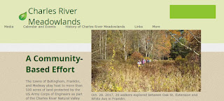
Oct. 28. 2017, 20 walkers explored between Oak St. Extension and White Ave in Franklin. (courtesy photo)

Sunday, May 13, 2018

Charles River Meadowlands Initiative Walk/Cleanup - Apr 28

Several people interested in the Charles River Meadowlands Initiative participated in a walk and cleanup on Saturday from noon to 1:30 in conjunction with Town ‘Earth Day’ cleanup on April 28. 

Tom Betts, site supervisor at the Montage condominium project under construction on Pond Street, kindly gave permission to the group to park and access the adjacent town lands. The Montage project will eventually include a public access component and parking for reaching town and federal land. 

During the Saturday walk, attendees filled two bags with trash, explored existing trails, and assessed federal and state signage on the property borders. 

The Meadowlands Initiative is meeting next week with the town administration and representatives of the Army Corps of Engineers, which is in charge of some 400 acres of land in Franklin, to explore ways to improve public access and improve conservation.

For more about the Charles River Meadowlands Initiative visit their page
charlesrivermeadowlands.org

L-R Paul Sager, Alan Earls, Juanita Urban

Tuesday, May 1, 2018

“We control the money that’s spent at that plant”

From the Milford Daily News, articles of interest for Franklin:

"The Charles River Pollution Control Board is seeking Franklin volunteers to take the place of long-time member Eugene Guidi, who is taking his leave after 19 years. 
“We need members there,” he said. “It’s hard to get people to join.” 
The Charles River Pollution Control District includes a regional wastewater treatment plant located in Medway that treats up to 5.7 million gallons a day.
The board is designed to have three Franklin members, but hasn’t had a third member for quite some time, Guidi said. With him and his nearly two-decades experience also on the way out, the town is seeking interested volunteers in a multitude of relatable fields.
 
“People on the board have been finance people, insurance people, construction people, engineering people,” he said. “We’re really overseeing and auditing the operation of a business.”

Continue reading the article online (subscription may be required)
http://www.milforddailynews.com/news/20180430/franklin-residents-asked-to-help-oversee-charles-river-pollution-control-district

Posted earlier on Franklin Matters:
http://www.franklinmatters.org/2018/04/franklin-residents-charles-river.html


VACANCY- Charles River Pollution Control District 
The Town of Franklin encourages residents who are interested in volunteering to apply now. If you have been curious or interested in giving your time, expertise or perspective on behalf of your community, now is an excellent time to get involved. 
For more information on the Charles River Pollution Control District please visit the Boards page here:  http://www.franklinma.gov/charles-river-pollution-control 
To apply please visit the Town's website and fill out the online volunteer form at: http://franklinmaboards.vt-s.net/newcaf.php


Franklin Residents: Charles River Pollution Control District - Volunteer Opportunity

Friday, April 27, 2018

Franklin Residents: Charles River Pollution Control District - Volunteer Opportunity

VACANCY- Charles River Pollution Control District

The Town of Franklin encourages residents who are interested in volunteering to apply now. If you have been curious or interested in giving your time, expertise or perspective on behalf of your community, now is an excellent time to get involved.

For more information on the Charles River Pollution Control District please visit the Boards page here: http://www.franklinma.gov/charles-river-pollution-control

To apply please visit the Town's website and fill out the online volunteer form at: http://franklinmaboards.vt-s.net/newcaf.php

Franklin Residents: Charles River Pollution Control District - Volunteer Opportunity

Sunday, December 31, 2017

Charles River Meadowlands Initiative: Information and Children's Reading - Feb 2

To kick of 2018, the Charles River Meadowlands Initiative will be holding an information session on Feb. 2, International Wetlands Day AND Groundhog Day. We will be offering literature, information and a slideshow from 3-6 PM at the Franklin Public Library in the ground floor meeting room. Feel free to stop by and encourage anyone who might be interested to come, too. 

In ADDITION, we are co-sponsoring a reading of meteorologist Mish Michael's book, Ms. G. and Her Shadowy Road to Fame -- a children's book loosely based on the state's real life "official" Groundhog! Franklin Town Councilor Melanie Hamblen will be the guest reader at 3:30 in the Children's Room at the Library. For further information about the Ms. G. program, contact Children's Librarian Calleigh Keating (ckeating@minlib.net).

http://www.mastategroundhog.com/ms-g/ms-gs-shadowy-road-to-fame


For more about the Ms. G. book
http://www.mastategroundhog.com/ms-g/ms-gs-shadowy-road-to-fame

For more about the Charles River Meadowlands Initiative
https://www.charlesrivermeadowlands.org/ 


Friday, December 29, 2017

Review of Meadowlands Initiative in 2017; Events for your 2018 Calendar

The Charles River Meadowlands Initiative looks back on a busy 2017 and forward to a promising new year. During the course of the year we met several times as a group to discuss plans and opportunities. The First Universalist Society of Franklin was a generous host and Sue Bencuya and Paul Sager provided coordination and opened the premises for us. We have continued to receive guidance from the Metacomet Land Trust and active participation from Metacomet Treasurer Susan Speers.

We also had a chance to provide written input and suggestions to the US Army Corps of Engineers (USACE) in its periodic review of its Master Plan for the Charles River Natural Valley Storage Area, the land holdings of which are the focus of our efforts in Bellingham, Franklin, and Medway. Significantly, this document outlines the tripartite mission of the Corps relative to the CRNVSA – namely flood control, conservation, and recreation. During a public hearing held in Millis on April 19 by the USACE, a large contingent of Meadowlands people participated – offering comments and suggestions and strongly emphasizing the expectation that the Corps will do more in the future to support the recreation aspect of its mission through helping to develop access points, launching sites, etc.

We presume that concerns expressed at the hearing have been acknowledged and recognized in the document. At this writing, the finalized Master Plan is working its way through the USACE as it awaits final approval. When that occurs, we expect that the local Corps officials will be able to meet again and, in particular, will respond to a pending meeting request to discuss the Meadowlands, made by the Town of Franklin.

At the request of a Meadowlands participant from Bellingham we also shared the "message" about the desirability of preserving the lands surrounding the CRNVSA holdings as the town prepared to approve the economic development of a large land parcel. While we were pleased to have this opportunity, in fact the town had been working with the developer of the site along High Street in Bellingham, to reserve a buffer area close to the Charles for walking trails and to minimize disturbance to the land. This now appears to be "baked in" to the process – a real boon for a beautiful and now more accessible area.

State Representative Jeff Roy is continuing to monitor the fate of the earmark he proposed and passed along with Rep. Kevin Kuros and former Rep. John V. Fernandes on behalf of the Initiative. As is often the case with state spending, authorized funds are used subject to the discretion of the administration; so, whether this money will eventually turn into action at the relevant state agency is still anybody's guess.

In October, the Initiative held an ambitious walk – and slog – between Oak Street Extension in Franklin and White Ave in Franklin. The event attracted about 20 local residents. Although there is a narrow margin of dry Federal land, we initially opted for the wetter route to avoid brambles and private property. However, the route eventually emerged into beautiful upland fields and tall stands of evergreens rarely visited by people. Two Franklin town council candidates attended the event. The event showed that the long-term possibility of connecting multiple points along the eastern side of Mine Brook, though the route nearest Oak Street Extension will clearly require more engineering. [We have also been reminded by the Franklin Conservation Agent that ConCom restrictions will loom large.]

Finally, in December, we provided a short document – requested earlier in the year by the Franklin Town Administrator -- describing the most achievable near-term actions that the town could take to enhance access to the Meadowlands via town land. These suggestions included working closely with the developer of the Montage condominiums on Pond Street to link their planned trails to existing marked trails in town lands extending to White Avenue. At present, the developer is committed to providing a small public parking lot with access to a loop trail around the property and a spur directly to Mine Brook to permit launching small watercraft. [NOTE: Parallel discussions with the Town Planner have this action under study – with plans to get a town GPS team on site early in 2018 to make the proposal more concrete and specific.] Potential key additions to town lands were also outlined as well as a suggestion that signage be provided at trail heads and that the town investigate the feasibility of adding downstream access to Mine Brook. Lastly, we suggested a "second look" at a canoe launch to the Charles River proposed many years ago from Plain Street and put off due to site conditions. With the removal of the dam upstream of this location (Pearl St. Bellingham), the site may have new relevance.

Review of Meadowlands Initiative in 2017
Looking ahead to 2018 we hope to continue meeting periodically as needed for planning purposes but the year will be kicked off on Feb. 2 (Groundhog Day and World Wetlands Day) with an information session for the general public at the Franklin Public Library from 3-6 pm. We are also "sponsoring" a related activity in the Children's Room – a reading of "Ms. G's Shadowy Road to Fame" (a fictionalized treatment of the story of our official State Groundhog!) with Town Councilor Melanie Hamblen as volunteer reader.

On April 22 (Earth Day), we will lead a walk into the Franklin section of the Meadowlands – time and location to be announced.

Other suggestions for 2018 are welcome. Please send them along!

Sincerely,

Alan Earls​
www.charlesrivermeadowlands.org


Wednesday, November 1, 2017

Charles River Meadowlands hike recap

The Oct. 28 Charles River Meadowlands hike attracted a total of 20 people. The group made it through the rugged, wet, and overgrown terrain south of Oak Street Extension, eventually emerging in beautiful upland fields and tall stands of evergreens, ultimately exiting via White Avenue. 

Two town council candidates attended the event: Eamon McCarthy Earls and Andy Bissanti. 

“It was great to have so many people exploring this area,” said Meadowlands organizer, Alan Earls. “We got to see the challenges for trail development in the wetter areas as well as the enormous potential in the extensive field and forest sections,” he added.

Charles River Meadowlands hike recap