Showing posts with label conservation commission. Show all posts

Saturday, February 4, 2017

Exploring the Charles River Meadowlands

On Jan. 31, the Charles River Meadowlands Initiative (www.charlesrivermeadowlands.org) led a group of activists, local officials from Bellingham, and legislators Jeff Roy and Kevin Kuros to discuss plans for 2017 as well as a long term vision for the area. 

The group started on Pearl Street in Bellingham where the town recently demolished an industrial facility and removed a mill dam, opening up access to a section of the Charles River. Later, the group visited two sites in Franklin that provide direct access to the Charles River Meadowlands and could become starting points for trails and bike paths in the future.

"The crucial thing we focused on today was the ways in which each of these areas along the Charles or its Mine Brook tributary can be linked, bringing our communities closer together, providing recreation, and even offering alternative transportation routes to shopping and entertainment," said Alan Earls, founder of the Initiative.

The next meeting of the Charles River Meadowlands initiative will be in the Dean Room of the First Universalist Society, Franklin at 262 Chestnut St, Franklin at 6:30 PM on Feb. 7. We will discuss these goals and we will be looking for help identifying access points and existing trails and planning more meetings with officials.

​For further information, contact Alan Earls (alan.r.earls@gmail.com)

Members of the Charles River Meadowlands Initiative met with officials from Bellingham and state legislators on Tuesday (Photo courtesy of Marjorie Turner-Holman)

Thursday, January 19, 2017

DelCarte Pond Herbicide Treatment - Timeline for 2017


During 2017 and 2018, herbicide treatments will be applied to the DelCarte Ponds as part of the restoration and preservation of this important recreation area. The treatments are designed to eliminate the invasive plant species which are proliferating rapidly and threaten to completely “take over” the waterbodies unless action is taken to stop their spread.

The time frame for this work is as follows:

  • Prepare and File MA DEP License to Apply Chemicals Permit - APRIL
  • Pre-Treatment Survey – MAY
  • Variable Milfoil Treatment – EARLY JUNE
  • Initial Water Chestnut Treatment – EARLY JUNE
  • Interim Survey – LATE JUNE
  • Follow-Up Water Chestnut Treatment – EARLY JULY
  • Final Post-Treatment Survey – AUGUST/SEPTEMBER
  • Year-End Report – NOVEMBER/DECEMBER

Signs will be posted at the ponds concerning this work it is important to bear in mind that ON THE DAY OF THE TREATMENTS, USE OF THE PONDS WILL BE RESTRICTED.

Any questions on this project should be directed to the Conservation office at 508-520-4929.

The northern pond at DelCarte in winter

This was shared from the Town of Franklin webpage
http://www.franklinma.gov/sites/franklinma/files/news/delcarte_pond_herbicide_treatment_notice_0.pdf

Sunday, September 4, 2016

Black Knot Disease at Dacey Field

"In August 2016, Conservation Commission staff discovered Black Knot Tree Disease on various Black Cherry trees at Dacey Field. The most impacted areas consist of dense Eastern White Pine stands with Black Cherry trees mixed in. 
The ‘Nature Walk’ section of Dacey has many infected trees. Black Knot is a disease caused by fungal parasite, Trichothecium roseum, and leaves charcoal-like lumps on branches and twigs of trees, especially trees in the Prunus family. 
The disease can bring leaf wilt and also death of leaves, twigs, branches, and even the entire tree. Winter management efforts include pruning and sanitation of trees that have not been heavily impacted. The infected branches and twigs should be burned, buried, or removed from the site eliminate the spread of the disease. 
Fungicides have been used successfully in severely impacted areas. It is recommended that an experienced arborist explore Dacey to determine how severely the disease has spread throughout the forest before management efforts are made. From a quick run through, more than half the Black Cherry trees observed were infected."

black knot disease photo from American Phytopathological Society
black knot disease photo from American Phytopathological Society

References:

http://www.apsnet.org/edcenter/intropp/lessons/fungi/ascomycetes/pages/blackknot.aspx

http://www.ct.gov/caes/lib/caes/documents/publications/fact_sheets/plant_pathology_and_ecology/black_knot_of_ornamental_plum_and_cherry_4-02-08r.pdf

http://www.extension.umn.edu/garden/yard-garden/trees-shrubs/black-knot/


  • This information was shared from the Town of Franklin page

http://franklin.ma.us/Pages/FranklinMA_News/024BA541-000F8513


  • For more info about the Conservation Commission, visit their page

http://town.franklin.ma.us/Pages/FranklinMA_Conservation/index

Saturday, September 3, 2016

DelCarte Open Space Guidebook

The Guide Book for DelCarte Open Space Area has been published. Much of it seems to have been repurposed from the invasive species study conducted last year, this guide book focuses less on the technical aspects of the recreational space and more on how to utilize the space. Trail maps, sample photos of the wild life and fish are included.

You can read it and download it from here


or here
https://drive.google.com/open?id=0B0wjbnXDBhczdXV2UkM5NkFxc2M


Or from the Town of Franklin webpage here
http://franklin.ma.us/Pages/FranklinMA_News/024BA540-000F8513

on the northern pond at DelCarte


  • The full study can be found here

http://www.franklinmatters.org/2016/02/ecological-and-management-study-of.html

Wednesday, August 24, 2016

New nature blog for Franklin's natural areas


Attention nature-lovers of Franklin, MA: As part of my internship with the Franklin Conservation Commission, I have created a public nature blog for the natural areas around town. The blog provides a great opportunity for citizens science, or gathering information/data from the general public, to keep an inventory on the flora and fauna of the sites.  
In addition, the blog will be used as an aid to track the impacts of climate change as the areas experience seasonal transitions.  
If you utilize the beautiful conservation areas in Franklin and would like to contribute to the blog by reporting a sighting, please go to https://franklinmanature.wordpress.com/ and follow the instructions.  
Thank you!
https://franklinmanature.wordpress.com/

Tuesday, July 5, 2016

Conservation Commission discusses the DelCarte Open Space (video)

Conservation Agent George Russell and Conservation Commission Chair Jeff Livingstone sat down with Ken Norman in the fall of 2015 to talk about the work of the Conservation Commission and DelCarte Open Space.


  • The study mentioned can be found here:

http://www.franklinmatters.org/2016/02/ecological-and-management-study-of.html

The Town Council did approve funding for the remediation steps outlined to gradually reduce the invasive plant species in the water.


A recent photo shows the spread of water lilies and other plants over the water surface at DelCarte


Thursday, May 19, 2016

Save Spruce Pond Brook - Stop Madalene Village Development

The continuation of the hearing on the developer's proposal for Madalene Village is scheduled for Thursday, May 19 at 7:50 PM. The Zoning Board of Appeals full agenda for this meeting can be found here

http://town.franklin.ma.us/Pages/FranklinMA_ZBAAgendas/Agendas%202016/05-19-16%20ZBA%20Meeting.pdf


7:50 PM 

21 Peck Street and 180 Cottage Street, Madalene Village - MV Cottage Development LLC Applicant is seeking a building permit to construct a 40 unit townhome style development. The building permit is denied without a comprehensive permit from the ZBA.


a view of the brook from Wachusetts St


https://drive.google.com/file/d/0B0wjbnXDBhczbmptU2piU29nTU0/view?usp=sharing

Sunday, April 24, 2016

"we use the trail often, and it's nice to give back"


"The town held a volunteer cleanup of its DelCarte Conservation Property on Saturday in what officials hope will become an annual tradition. 
The event - which ran from 8 a.m. to 11 a.m. at the Pleasant Street property - had people picking up trash, planting and raking. 
Conservation Commission member Tara Henrichon, who helped organize the cleanup, said the event was going "amazingly well." 
"We have about 20 to 25 people so far," she said. "There are a bunch of projects - we're adding natural plants to the rain garden and about 10 to 12 people are out on the trails... We're also clearing out invasive plants."
Continue reading the article online (subscription may be required)
http://www.milforddailynews.com/news/20160423/franklin-being-kind-to-mother-nature

Folks out and about cleaning up at DelCarte

The ladies from Starbucks with full trash bags

Deputy Town Administrator Jamie Hellen helped to knock down and spread out a pile of mulch
It was good to see more than 30 people come out for this event. Town Administrator Jeff Nutting and several members of the Conservation Commission participated.

Thanks to Soren, a student from BFCCPS, who helped me work on spreading the pile of mulch.

Thursday, March 10, 2016

Big Night! Vernal Pools come alive in Franklin


With spring-like weather expected this week and into the next few weeks, the Conservation Commission reminds you to keep your eyes and ears open for signs of "Big Night".

Big Night is the term we use for those first few warm, rainy nights of spring. The warmer weather and rain cue wood frogs and salamanders to begin migration, through forests and across roadways, to local vernal pools to breed. Vernal pools, as their name suggests are small depressions that collect snow melt and rain in the spring and fill for just a few short months, providing a safe place for some frogs and salamanders to breed.

These animals live in the uplands during most of the year and move in large numbers to the pool they were hatched in on these nights. If you’re lucky, you’ll hear wood frogs (they sound a little like quacking ducks) and spring peepers in the next few weeks.

If you are lucky enough to witness or hear nature's musings, please enjoy! And then do not forget to call the Conservation Department at 508-520-4929 to report it.

You can learn more about vernal pools here: vernalpool.org

image from vernalpool.org

This was shared from the Franklin webpage
http://franklin.ma.us/Pages/FranklinMA_News/02358E87-000F8513

Friday, February 26, 2016

Real time reporting: Town Council Meeting - Feb 24, 2016

Present: Pellegri, Padula, Mercer (via phone), Vallee, Kelly, Pfeffer, Bissanti, Dellorco, Jones
Absent: none

 screen grab of Spectra Energy presentation via the video broadcast
screen grab of Spectra Energy presentation via the video broadcast

Here is the Storify capture of my notes for the meeting recorded via Twitter:
(be sure to scroll within the Storify widget to review all the entries)


screen grab of video replay for Town Council meeting 2/24/16


There will be a Part 2 to cover the portion of the meeting missed.
http://www.franklinmatters.org/2016/02/town-council-meeting-22416-missing.html

Town Council meeting 2/24/16 - missing portion

I was able to report on the Council meeting via the live broadcast for a portion of the Wednesday meeting. Left to handle a business meeting and returned to catch the end of the lengthy meeting. This portion I caught via the video replay.

As with the other Storify summaries I have posted, be sure to scroll within the widget to see all the entries.


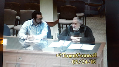
A member of the Conservation Commission and the Franklin Conservation Agent George Russell


Sunday, February 21, 2016

Franklin, MA: Town Council - Agenda - Feb 24, 2016


A. APPROVAL OF MINUTES
– January 20, 2016, February 3, 2016

B. ANNOUNCEMENTS
– This meeting is being recorded by Franklin TV and shown on Comcast channel 11 and Verizon channel 29. This meeting may also be recorded by others.

C. PROCLAMATIONS/RECOGNITIONS

D. CITIZEN COMMENTS
– Citizens are welcome to express their views for up to five minutes on a matter that is not on the Agenda. The Council will not engage in a dialogue or comment on a matter raised during Citizen Comments. The Town Council will give remarks appropriate consideration and may ask the Town Administrator to review the matter.

E. APPOINTMENTS

  • Disability Commission
  • Election Workers
  • Council on Aging


F. HEARINGS

G. LICENSE TRANSACTIONS

H. PRESENTATIONS/DISCUSSIONS
1. Spectra Energy 
2. Conservation Commission
- Delcarte Property 
- Wetland Bylaw

I. SUBCOMMITTEE REPORTS 
– Community Liaison Update

J. LEGISLATION FOR ACTION

  1. Resolution 16-08: Appropriation: Facilities Van
  2. Resolution 16-09: Rescind Borrowing Authority (Resolution 15-15, Purchase and Renovation of Improved Property for Franklin Recreation Department) Fund Through Appropriation
  3. Resolution 16-10: Ratification of the Memorandum of Agreement Between the Department of Public Works, ASFME – Local 1298, Council 93 and the Town of Franklin


K. TOWN ADMINISTRATOR’S REPORT

L. OLD BUSINESS

M. NEW BUSINESS

N. COUNCIL COMMENTS

O. EXECUTIVE SESSION
- Pending or threatened litigation
1. Proposed Excelon expansion of Medway electric generating facility pending before Energy Facilities Siting Board.

P. ADJOURN

The documents released for this meeting can be found here
http://town.franklin.ma.us/Pages/FranklinMA_CouncilAgendas/2016%20Complete/02242016.pdf

DelCarte in fall color

Saturday, January 2, 2016

Planning for the US Army Corps of Engineers Natural Valley Storage Area

From Alan Earls

​Dear Colleagues and Neighbors, 
I am writing to you in regard to the hundreds of acres of mostly contiguous open space land within Bellingham, Franklin and Medway that are part of the US Army Corps of Engineers Natural Valley Storage Area. I have had the opportunity to meet most of you at some point in the last 10 months so you will be aware of my effort to gather support for improved public access to this land. In the course of this period I have met with Metacomet Land Trust, the Conversation Commission of Bellingham, and the Open Space Committee of Medway as well as talking with several officials in Franklin. 
In September Representative Jeff Roy (D-Franklin) and Representative Kevin J. Kuros (R- Uxbridge) joined me for a morning of driving and walking around the property. Both men expressed surprise at the extent of the property and indicated a willingness to seek “seed” funding, perhaps for an engineering study, to look at how public access could be improved.

In hopes of building some momentum together, I have reserved a meeting room at the King Street fire station in Franklin to discuss how those of us in each of our three communities can better work together toward this goal while also working effectively with US and Massachusetts officials involved in management of the property. 
Specifically, I would like to include on the agenda:

  • Developing an inventory of existing or potential public access points...
  • Sharing experience/insights about working across communities and state/federal jurisdictions
  • Clarifying potential “next steps” toward making the “Charles River Meadowlands” an integral part of the open space picture across our three towns.
Mine Brook flows into the Natural Valley Storage Area


The meeting will be held on Thursday, Jan 28, 2016 from 6:30- 8:30 PM


LOCATION:

  • John Durand Memorial Fire Station
  • Station #2
  • 600 King Street
  • Franklin, Massachusetts

Sunday, December 27, 2015

Annual Report - 2015: Conservation Commission


The Franklin Conservation Commission is responsible for promoting and protecting the natural resources of Franklin and protecting the town’s watershed resources. A large part of the Commission’s attention is directed to administering Massachusetts and Franklin wetland protection laws and regulations. Those laws and regulations require the Commission permits to work in or within 100 feet of a wetland, in the 100 year flood hazard zone or within 200 feet of a perennial stream.

The Commission is comprised of up to seven volunteer residents appointed for three year terms by the Town Administrator. The current members of the Commission have diverse professional experience related to environmental science, biology, engineering, landscape design, and project management. Because of their different backgrounds, each commissioner is able to offer a different perspective during the review of applications for a wetland permit that ultimately benefits Franklin.

Franklin has continuously been well represented at the annual conference of the Massachusetts Association of Conservation Commissions in March, with Commissioners attending classes and workshops and talking with other Commissioners from across the state as well as lawyers, ecologists and engineers active in conservation.

The Commission, via its Chairman, has also participated in the Keystone Project, which is organized and run by UMASS. The Keystone Project is designed to stimulate forest landowners and community opinion leaders to be advocates of sound forest conservation, and to help inform the land management and conservation decisions of their friends, neighbors, organizations, and communities.

In 2012, the EPA proposed regulations to reduce the amount of phosphorus in storm water runoff into the Charles River basin, with Franklin, Bellingham and Milford as the pilot communities These regulations remain at a standstill as the EPA continues to work out the regulatory details. The Commission monitors the status of these regulations while encouraging and advising on appropriate stormwater management practices where applicable in Conservation jurisdiction.

The Commission continues to work on the DelCarte Area (aka the Franklin Reservoirs) off of Pleasant Street. There are a series of seven “structures” (six dams that had been originally used for cranberry farming and a stone wall that beavers had dammed) along Miller brook thru the 100+ acre DelCarte Area. The dams are identified serially from Dam #1, located closest to downtown adjacent to the MBTA Dean station, to #6, located furthest downstream, closest to Miller Street. The Commission is currently in the process of investigating the undertaking of an ecological study to ascertain the flora and fauna viability in the pond.

DelCarte in full fall color

Since the last annual report, the Conservation Commission has received 63 permit applications to work within areas under their permitting jurisdiction. These applications range from the removal of dead trees in a buffer zone to the construction of industrial buildings and associated drainage. The Commission also issued 26 certificates of completion for various projects and granted extensions to allow projects to finish. Two emergency certifications were also issued to the Franklin Dept. of Public Works. In addition, based on the snow emergency declared by DEP in Feb-March 2015, emergency snow storage permissions were developed and issued.

The Commission would like to draw the attention of the Town’s residents to the many protected natural areas in the Town and the opportunities for passive recreation they enable:

  • The DelCarte Area, with parking off of Pleasant Street, has recently improved walking trails through woodlands along a series of ponds. Two canoe launches and an above-water boardwalk to completely connect the trail system have been installed.
  • Several Eagle Scout and school/class projects have been completed or are on-going in the DelCarte and Dacey Field areas, and the town forest.. These projects have helped in the clearing of trails and the erecting of educational signage and the cleaning up of debris. Additional projects are being undertaken in the Town Forest to improve the existing trail system; The Town Forest has good access points off of both Summer Street and Russet Hill Road with a network of walking trails thru woodlands and across Uncas Brook;
  • There is a network of walking trails that cross Shepards Brook and go thru fields and woods behind the Dacey Recreation Area off Lincoln Street;
  • Indian Rock has good access off of both King Phillip Road and Lost Horse Trail with walking trails thru woodlands near two large vernal pools and to the top of historic Indian Rock;
  • The Metacomet Land Trust owns several pieces of protected land, notably the walking trails off of Bridle Path and The Lady Bug Trail near JFK school;
  • The Franklin State Forest is accessible off of Grove Street and Forge Hill Road and boasts an extensive network of walking and ORV trails;
  • The SNETT trail goes all the way to Douglas. There is a Town parking lot off of Grove Street. The Trail section from Prospect Street into Bellingham is currently being reconstructed by the Dept. of Conservation and Recreation. The reconstruction was permitted by the Commission in early 2015;
  • The expansive marsh near Interstate 495 exit #17 is the US Army Corps of Engineers Natural Valley Flood Storage Project, preserved to protect against downstream flooding in the Charles River basin. That marsh is along Mine Brook, the largest stream in town, draining about half of Franklin, starting at the extreme south end of Franklin, passing underneath Washington Street, Beaver Street, 495, Grove Street, West Central Street, 495 again, Beech Street, and Pond Street before finally meeting the Charles River on the Medway border.
  • Other significant streams in Franklin include Shepards Brook, Miller Brook, Uncas Brook and Bubbling Brook. Lake Populatic is part of the Charles River, the other navigable ponds in Franklin are Spring (Green’s) Pond, Beaver Pond, and Uncas Pond, the last two of which are listed as Great Ponds by Mass DEP. There are many other natural areas in Franklin waiting to be explored.


The Commission would also like the town residents to be aware of the potential tax savings of M.G. L. Chapter 61 (forest land), 61A (agricultural land) and 61B (recreational land). Such programs are designed to benefit the land owner via reducing the tax burden as well as to preserving and
maintaining the quality and quantity of environmentally sensitive and natural areas within the commonwealth.


Conservation Commission Members:

Jeff Livingstone – Chair
Paul Harrington - - Vice Chair
Scott McLean
Ravi Pendkar
Steve Younis
Bill Batchelor

Respectfully submitted,

Jeff Livingstone, Chair

Please visit our website for additional information including application forms, and regularly posted Conservation Commission agendas and meeting minutes at http://town.franklin.ma.us/Pages/FranklinMA_Conservation/index


-----------

"Prior to November 1 of each year, the Town Clerk shall cause to be prepared and made available to the inhabitants of the Town an annual report for the preceding fiscal year which shall include: the annual Town budget, the reports of all Town officers, the records of all Town Council bylaw amendments and resolutions, an abstract of births, marriages and deaths, and the wages, salaries, or other compensation of all Town employees." [Added 5-2-2012 by Bylaw Amendment 12-681]

Shared from the full and complete PDF version of the Town of Franklin Annual Report for 2015


Saturday, December 19, 2015

In the News: Dean security changes hands, retention or wetland?

From the Milford Daily News, articles of interest for Franklin

Campus police officers at Dean College had their last day on the job Friday, as they were replaced by a private security company. 
Michael Carmody, a former Public Safety sergeant, said once the overnight shift ended at 8 a.m., the private security firm, TeamOps, took over.

Continue reading the article online here (subscription may be required)
http://www.milforddailynews.com/article/20151218/NEWS/151215815/1994/NEWS


The Town Council may look to review a local bylaw that protects some man-made retention ponds as wetlands. 
The matter came up at Wednesday's council meeting in which DPW Director Robert "Brutus" Cantoreggi proposed an amendment to the bylaw that would enable town workers to perform maintenance on such ponds. 
"The town has over 90 retention ponds that we do maintenance on," he said.

Continue reading the article online here (subscription may be required)
http://www.milforddailynews.com/article/20151218/NEWS/151215812/1994/NEWS

Sunday, December 28, 2014

Franklin Annual Report 2014: Conservation Commission


The Franklin Conservation Commission is responsible for promoting and developing the natural resources of Franklin and protecting the watershed resources of Franklin. A large part of the Commission’s attention is directed to administering Massachusetts and Franklin wetland protection laws. Those laws require the Commission to hold public hearings or meetings before issuing a permit to work in or within 100 feet of a wetland, or 200 feet of a perennial stream.

The Commission is comprised of up to seven volunteer residents appointed for three year terms by the Town Administrator. The Commission may also have up to two non-voting associate members. The members of the Commission have diverse professional experience related to environmental science, biology, engineering, landscape design, and project management. Because of their different backgrounds, each commissioner is able to offer a different perspective during the review of applications for a wetland permit that ultimately benefits Franklin.

In November 2013, the Town hired George Russell, AICP, as Conservation Agent. George is a Professional Planner/Conservation Agent with over 30 years of experience in the field. Franklin was well represented at the annual conference of the Massachusetts Association of Conservation Commissions in March, with Commissioners attending classes and workshops and talking with other Commissioners from across the state as well as lawyers, ecologists and engineers active in conservation.

In 2012, the EPA adopted regulations to reduce the amount of phosphorus in storm water runoff into the Charles River basin, with Franklin, Bellingham and Milford as the pilot communities. These regulations are in response to the public health threat posed by outbreaks of toxic algae blooms downstream fostered by high levels of phosphorus from storm water runoff. These regulations will require properties with more than two acres of imperious surfaces to improve storm water runoff treatment. Currently these regulations remain at a standstill as the EPA continues to work out the regulatory details. The Commission monitors the status of these regulations while encouraging and advising on appropriate stormwater management practices where applicable in Conservation jurisdiction.

The Commission continues to work on the DelCarte Area (aka the Franklin Reservoirs) off of Pleasant Street. There are a series of seven “structures” (six are dams that had been originally used for cranberry farming, the seventh is a stone wall that beavers had dammed) along Miller brook thru the 100+ acre DelCarte Area. The dams are identified serially from Dam #1 located closest to downtown adjacent to the MBTA Dean station to #6 located furthest downstream, closest to Miller Street. In 2012-3, rehabilitation of Dam #4 was completed and the work was been approved by the State Office of Dam Safety. Several Eagle Scout and school/class projects have been completed in the DelCarte and Dacey Field areas. These projects have helped in the clearing of trails and the erecting of educational signage.

Since the last annual report, the Conservation Commission has received 51 permit applications to work within the area under their permitting jurisdiction. These applications range from the removal of dead trees in a buffer zone, to the construction of 55 single family condominiums in a designed development. The Commission also issued 38 certificate of completion for various projects and granted 5 extensions to allow projects to finish.

The Commission would like to draw the attention of the Town’s residents to the many protected natural areas in the Town and the opportunities for passive recreation they enable:

  • The DelCarte Area, with parking off of Pleasant Street, has recently improved walking trails through woodlands along a series of ponds. A permit has been approved for installation of a canoe launch and an above-water boardwalk to completely connect the trail system; Dam Restoration, DelCarte Recreation Area
  • The Town Forest has good access points off of both Summer Street and Russet Hill Road with a network of walking trails thru woodlands and across Uncas Brook;
  • There is a network of recently improved walking trails that cross Shepards Brook and go thru fields and woods behind the Dacey Recreation Area off Lincoln Street;
  • Indian Rock has good access off of both King Phillip Road and Lost Horse Trail with walking trails thru woodlands near two large vernal pools and to the top of historic Indian Rock;
  • The Metacomet Land Trust owns several pieces of protected land, notably the walking trails off of Bridle Path and The Lady Bug Trail near JFK school;
  • The Franklin State Forest is accessible off of Grove Street and Forge Hill Road and boasts an extensive network of walking and ORV trails;
  • The SNETT trail goes all the way to Douglas. There is a Town parking lot off of Grove Street; (The town has a grant application pending with the state to improve this trail.)
  • The expansive marsh near Interstate 495 exit #17 is the US Army Corps of Engineers Natural Valley Flood Storage Project, preserved to protect against downstream flooding in the Charles River basin. That marsh is along Mine Brook, the largest stream in town, draining about half of Franklin, starting at the extreme south end of Franklin, passing underneath Washington Street, Beaver Street, 495, Grove Street, West Central Street, 495 again, Beech Street, and Pond Street before finally meeting the Charles River on the Medway border.
  • Other significant streams in Franklin include Shepards Brook, Miller Brook, Uncas Brook and Bubbling Brook. Lake Populatic is part of the Charles River, the other navigable ponds in Franklin are Spring (Green’s) Pond, Beaver Pond, and Uncas Pond, the last two of which are listed as Great Ponds by Mass DEP. There are many other natural areas in Franklin waiting to be explored.

The Commission would also like the town residents to be aware of the potential tax savings of M.G. L. Chapter 61 (forest land), 61A (agricultural land) and 61B (recreational land). Such programs are designed to benefit the land owner via reducing the tax burden as well as to preserving and maintaining the quality and quantity of environmentally sensitive and natural areas within the commonwealth.

Conservation Commission Members:
Jeff Livingstone – Chair
Paul Harrington
Marc Depoto - - Vice Chair 
Ravi Pendkar
Mark Cataldo 
Steve Younis
Dayna Gill

Respectfully submitted,

Jeff Livingstone, Chair

floating bridge was added to DelCarte to allow the trails to loop around the pond


Please visit our website for additional information including application forms, and regularly posted
Conservation Commission agendas and meeting minutes at www.franklin.ma.us.


The full annual report can be obtained from the Town Clerk's office (hard copy) or viewed and/or downloaded from the Franklin website here
http://town.franklin.ma.us/Pages/FranklinMA_Clerk/annual/2014report.pdf

Annual reports of prior years can also be found online at
http://town.franklin.ma.us/Pages/FranklinMA_Clerk/annual/


Friday, June 6, 2014

DelCarte Program - June 4, 2014

The program handed out at the ribbon cutting for the DelCarte Recreation and playground on Wednesday is available here for your reading (and download).

DelCarte Recreation and Conservation Area


The photos were here posted yesterday and also shared on Facebook


Please note: The recreation area is also conservation space so it will be a "what you carry in, you also carry out" place like other parks.

Tuesday, December 31, 2013

Annual Report 2013: Conservation Commission

Appropriately, our exploration of the Franklin Annual Report for 2013 has brought us to the Conservation Commission. They would like us to continue to explore Franklin's natural resources!

The Franklin Conservation Commission is responsible for promoting and developing the natural resources of Franklin and protecting the watershed resources of Franklin. A large part of the Commission’s attention is directed to administering Massachusetts and Franklin wetland protection laws. In short, those laws require the Commission to hold public hearings or meetings before issuing a permit to work in or within 100 feet of a wetland, or 200 feet of a perennial stream. 
The Commission is comprised of up to seven volunteer residents appointed for three year terms by the Town Administrator. The Commission also has up to two non-voting associate members. The members of the Commission have diverse professional experience related to environmental science, biology, engineering, landscape design, and project management. Because of their different backgrounds each commissioner is able to offer a different perspective during the review of applications for a wetland permit that ultimately benefits Franklin. 
In September 2012, the Town hired Michele Grenier, as Conservation Agent. Michele is a Professional Wetland Scientist with over 30 years experience in the field. 
Franklin was well represented at the annual conference of the Massachusetts Association of Conservation Commissions in March, attending classes and workshops and talking with other Commissioners from across the state as well as lawyers, ecologists and engineers active in Conservation. 
Last year, the EPA adopted regulations to reduce the amount of phosphorus in storm water runoff into the Charles River basin, with Franklin, Bellingham and Milford as the pilot communities. These regulations are in response to the public health threat posed by outbreaks of toxic algae blooms downstream fostered by high levels of phosphorus from storm water runoff. These regulations will require properties with more than two acres of imperious surfaces to improve storm water runoff treatment. Currently these regulations remain at a standstill as the EPA continues to work out the regulatory details. The Commission monitors the status of these regulations while encouraging and advising on appropriate stormwater management practices where applicable in Conservation jurisdiction. 
The Commission continues to work on the DelCarte area (aka the Franklin Reservoirs) off of Pleasant Street. There are a series of seven “structures” (six are dams that had been originally used for cranberry farming, the seventh is a stone wall that beavers had dammed) along Miller brook thru the 100+ acre DelCarte area. The dams are identified serially from Dam #1 located closest to downtown adjacent to the MBTA Dean station to #6 located furthest downstream, closest to Miller Street. Last year, Tighe and Bond, Inc. submitted a notice of intent for rehabilitation of dams #3 and #4 and the work has been completed. 
The Commission would like to draw the attention of the Town’s residents to the many protected natural areas in Town and the opportunities for passive recreation they enable:
  • The DelCarte area has parking off of Pleasant Street, with walking trails through woodlands along a series of ponds;
  • The Town Forest has good access points off of both Summer Street and Russet Hill Road with a network of walking trails thru woodlands and across Uncas Brook;
  • There is a network of walking trails that cross Shepards Brook and go thru fields and woods behind Dacey Recreation Area off Lincoln Street;
  • Indian Rock has good access off of both King Phillip Road and Lost Horse Trail with walking trails thru woodlands near two large vernal pools and to the top of historic Indian Rock;
  • The Metacomet Land Trust owns several pieces of protected land, notably the walking trails off of Bridle Path and The Lady Bug Trail near JFK school;
  • The Franklin State Forest is accessible off of Grove Street and Forge Hill Road and boasts an extensive network of walking and ORV trails;
  • The SNETT trail goes all the way to Douglas. There is a Town parking lot off of Grove Street;
  • The expansive marsh near Interstate 495 exit #17 is the US Army Corp of Engineers Natural Valley Flood Storage Project, preserved to protect against downstream flooding in the Charles River basin. That marsh is along Mine Brook, the largest stream in town, draining about half of Franklin, starting at the extreme south end of Franklin, passing underneath Washington Street, Beaver Street, 495, Grove Street, West Central Street, 495 again, Beech Street, and Pond Street before finally meeting the Charles River on the Medway border.
  • Other significant streams in Franklin include Shepards Brook, Miller Brook, Uncas Brook and Bubbling Brook. Lake Populatic is part of the Charles River, the other navigable ponds in Franklin are Beaver Pond, Uncas Pond, and Spring (Green’s) Pond.


There are many other natural areas in Franklin waiting to be explored. 
Conservation Commission Members:
Regan Ballantyne - Chair
Ray Willis - Vice Chair
Andy Tolland
Monique Allen
Jon Fournier
Jeff Livingstone
Marc Depoto
Margaret Stolfa - Associate Member
Andrew Riordan - Associate Member 
Respectfully submitted, 
Regan Ballantyne, Chair

Please visit our website for additional information including application forms, and regularly posted Conservation Commission agendas and meeting minutes at www.franklin.ma.us.


The full annual report can be obtained from the Town Clerk's office (hard copy) or viewed and/or downloaded from the Franklin website here
http://town.franklin.ma.us/Pages/FranklinMA_Clerk/annual/2013report.pdf

Annual reports of prior years can also be found online at
http://town.franklin.ma.us/Pages/FranklinMA_Clerk/annual/

Friday, January 4, 2013

Annual Report 2012: Conservation Commission


The Franklin Conservation Commission is responsible for promoting and developing the natural resources of Franklin and protecting the watershed resources of Franklin. A large part of the Commission’s attention is directed to administering Massachusetts and Franklin wetland protection laws. In short, those laws require the Commission to hold public hearings or meetings before issuing a permit to work in or within 100 feet of a wetland, or 200 feet of a perennial stream.

The Commission is comprised of up to seven volunteer residents appointed for three year terms by the Town Administrator. The Commission also has up to two non-voting associate members. The members of the Commission have diverse professional experience related to environmental science, biology, engineering, landscape design, and project management. Because of their different backgrounds each commissioner is able to offer a different perspective during the review of applications for a wetland permit that ultimately
benefits Franklin. That perspective continues to evolve, as one new member, Marc DePoto and two new Associate members joined the Commission during this last year.

In July 2012 the Commission and the Town was shocked and saddened by the sudden loss of our Conservation Agent, Mr. Nick Alfieri. A longtime resident and devoted Town employee, Mr. Alfieri was committed to upholding the interests of the Wetlands Protection Act and the Town of Franklin’s Wetlands Bylaw, while always being fair, helpful, and cooperative with local residents and business owners. We will
miss Nick and are thankful for his contributions to the Town and for his friendship.

In addition to conducting the regular schedule of public meetings to review applications for wetland permitting, the Commission updated its Policy Statement and Conservation Property Rules and Regulations document. The Commission also made an emergency revision to our Rules and Regulations, otherwise
residents would have lost their federal flood insurance.

Franklin was well represented at the annual conference of the Massachusetts Association of Conservation Commissions in March, attending classes and workshops and talking with other Commissioners from across the state as well as lawyers, ecologists and engineers active in Conservation.

Last year, the EPA unveiled its draft regulations to reduce the amount of phosphorus in storm water runoff into the Charles River basin, with Franklin, Bellingham and Milford as the pilot communities. These regulations are in response to the public health threat posed by outbreaks of toxic algae blooms downstream fostered by high levels of phosphorus from storm water runoff.

These regulations will require properties with more than two acres of imperious surfaces to improve storm water runoff treatment. Currently these regulations remain at a standstill as the EPA continues to work out the regulatory details. The Commission monitors the status of these regulations while encouraging and advising on appropriate stormwater management practices where applicable in Conservation jurisdiction.

The Commission continues to work on the DelCarte area (aka the Franklin Reservoirs) off of Pleasant Street. There are a series of seven “structures” (six are dams that had been originally used for cranberry farming, the seventh is a stone wall that beavers had dammed) along Miller brook thru the 100+ acre
DelCarte area. The dams are identified serially from Dam #1 located closest to downtown adjacent to the MBTA Dean station to #6 located furthest downstream, closest to Miller St. All of these structures are in various states of failure. Dams #5 & #5A (the stone wall) have completely failed, allowing their ponds to drain. All of the dams in the series have had signs posted on them because of the danger created by unstable beaver dams. Last year, the Town awarded a contract for Engineering and Design services to
Tighe & Bond, Inc. This spring, Tighe & Bond submitted a notice of intent for rehabilitation of
dams #3 and #4.

The Commission would like to draw the attention of the Town’s residents to the many protected natural areas in Town and the opportunities for passive recreation they enable:


  • The DelCarte area has parking off of Pleasant Street, with walking trails through woodlands along a series of ponds; 
  • The Town Forest has good access points off of both Summer Street and Russet Hill Road with a network of walking trails thru woodlands and across Uncas Brook; 
  • There is a network of walking trails that cross Shepards Brook and go thru fields and woods behind Dacey Recreation Area off Lincoln Street;
  • Indian Rock has good access off of both King Phillip Road and Lost Horse Trail with walking trails thru woodlands near two large vernal pools and to the top of historic Indian Rock;
  • The Metacomet Land Trust owns several pieces of protected land, notably the walking trails off of Bridle Path and The Lady Bug Trail near JFK school;
  • The Franklin State Forest is accessible off of Grove Street and Forge Hill Road and boasts an extensive network of walking and ORV trails;
  • The SNETT trail goes all the way to Douglas. There is a Town parking lot off of Grove Street;
  • The expansive marsh near Interstate 495 exit #17 is the US Army Corp of Engineers Natural Valley Flood Storage Project, preserved to protect against downstream flooding in the Charles River basin. That marsh is along Mine Brook, the largest stream in town, draining about half of Franklin, starting at the extreme south end of Franklin, passing underneath Washington Street, Beaver Street, 495, Grove Street, West Central Street, 495 again, Beech Street, and Pond Street before finally meeting the Charles River on the Medway border.
  • Other significant streams in Franklin include Shepards Brook, Miller Brook, Uncas Brook and Bubbling Brook. Lake Populatic is part of the Charles River, the other navigable ponds in Franklin are Beaver Pond, Uncas Pond, and Spring (Green’s) Pond.

There are many other natural areas in Franklin waiting to be explored.

Conservation Commission Members:

Regan Ballantyne - Chair
Ray Willis - Vice Chair
Andy Tolland
Monique Allen
Jon Fournier
Jeff Livingstone
Marc Depoto
Margaret Stolfa - Associate Member
Andrew Riordan - Associate Member

Respectfully submitted,

Regan Ballantyne, Chair


Please visit our website for additional information including application forms, and regularly posted Conservation Commission agendas and meeting minutes at http://franklinma.virtualtownhall.net/Pages/FranklinMA_Conservation/index


Published by the Town Clerk, this comes from the 2012 Annual Report
http://franklinma.virtualtownhall.net/Pages/FranklinMA_Clerk/annual/